HIKING

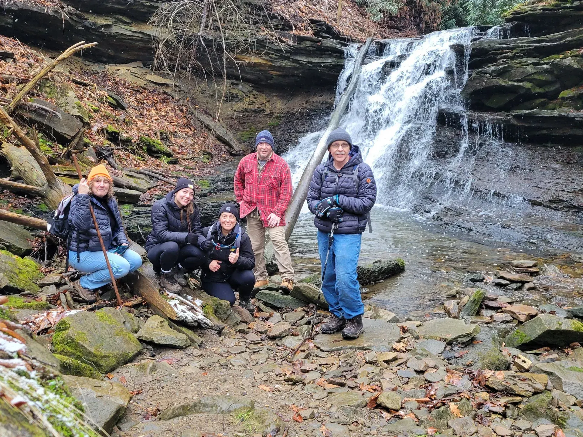
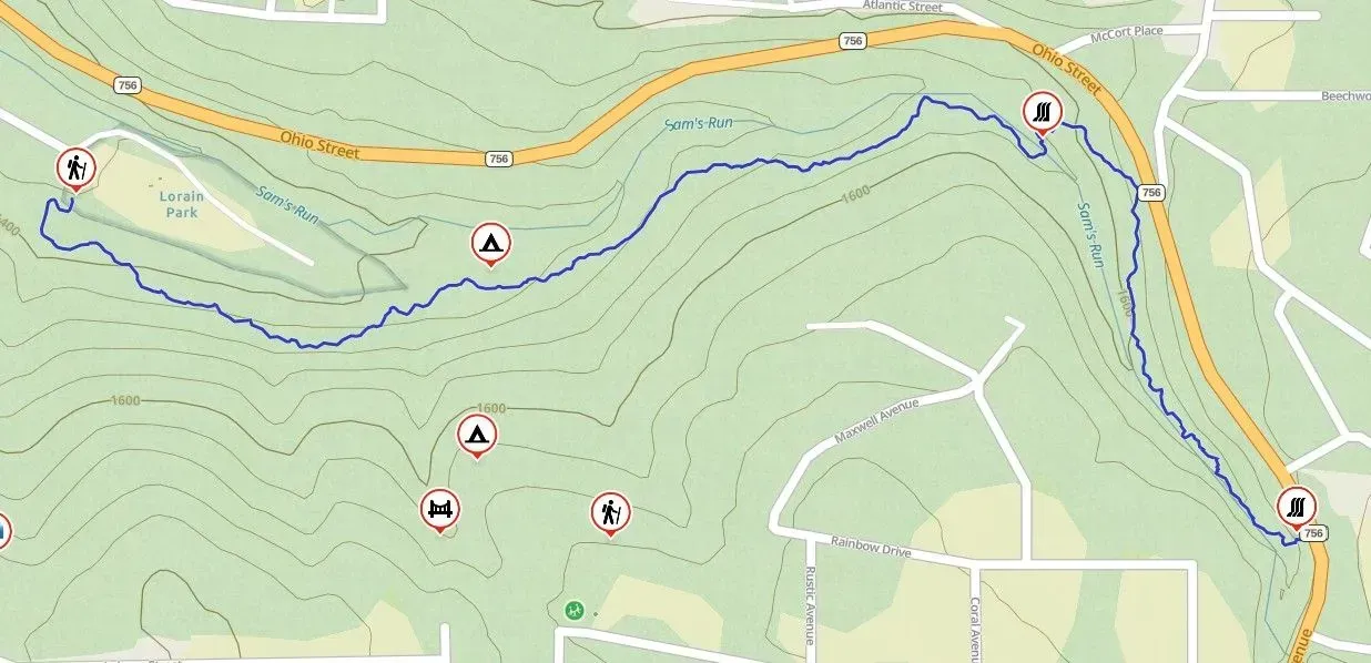
Pathway to the Falls
Trail Rating - INTERMEDIATE
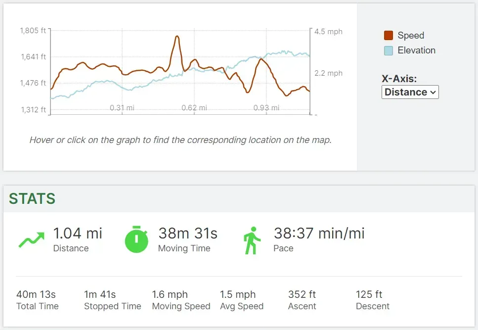
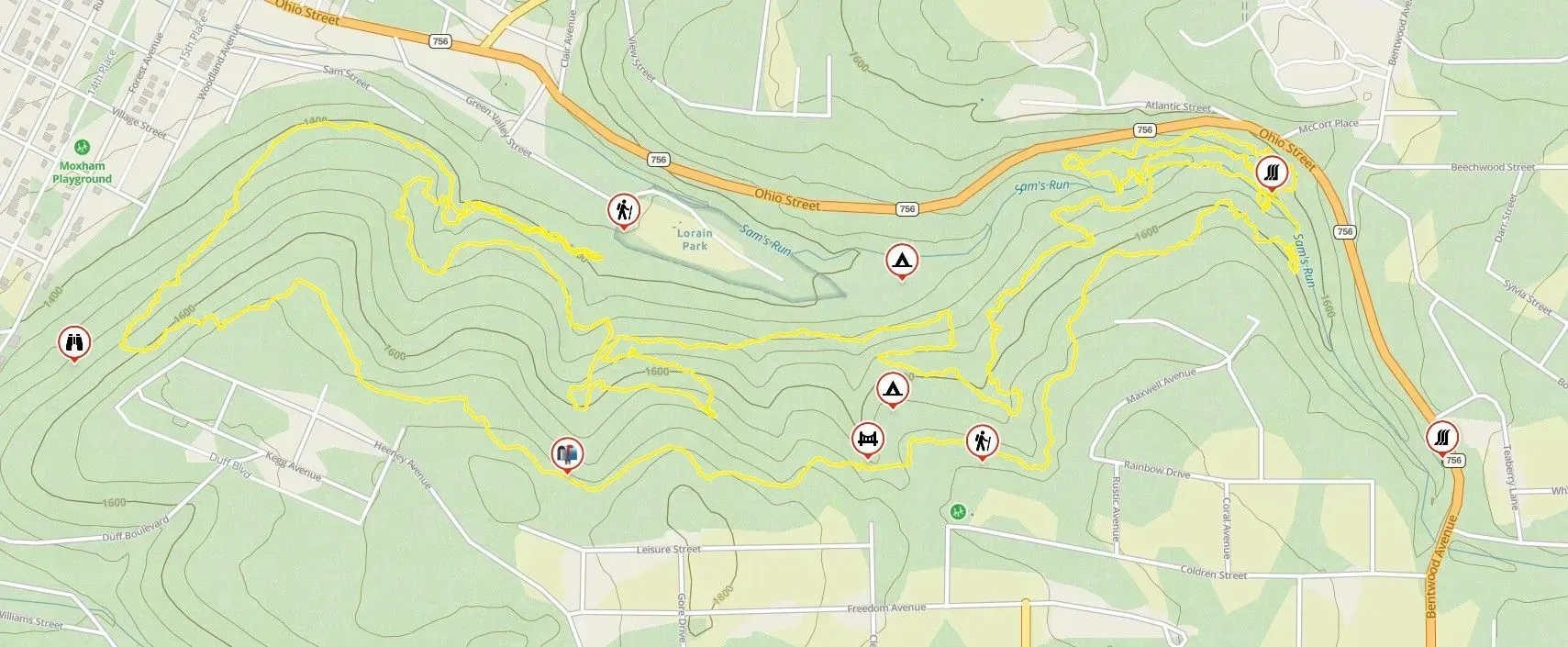
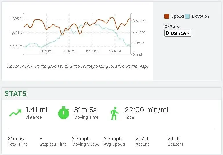
Pathway to the Falls Trail is blazed in blue. This trail is 2.2 miles round trip and takes you from the main trailhead to Turtle Falls. Turtle Falls is a fifteen foot waterfall that is nestled in the back of our trail system. This is a challenging hike as there are several climbs along with a 100 yard rock scramble up Sam's Run. Good boots, poles and hiking equipment is recommended.
Trail details below:
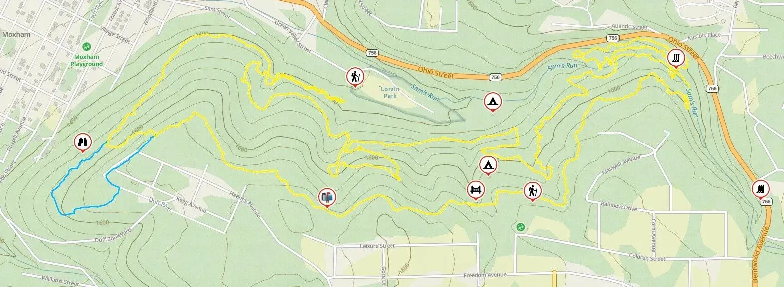
Map of the Earth
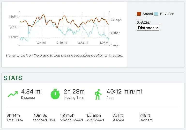
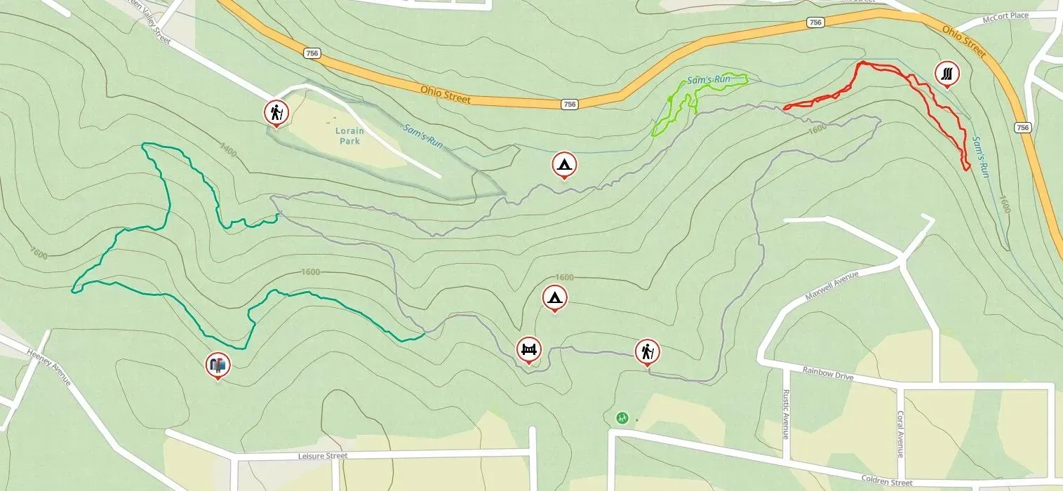
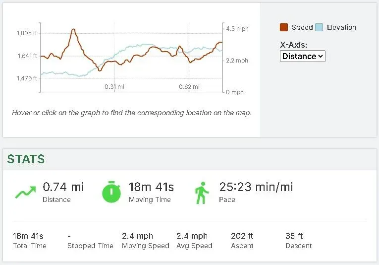
Map of the Earth Trail is our most advanced trail and it is blazed in yellow. Hiking boots and pole are recommended. The trail is 4.8 miles and creates a loop which splits about .25 miles into the trail. Either direction will bring you back to where you started so feel free to explore.
Trail Details Below
Whitetail Trail
Whitetail Trail is a 1.7 mile loop that is blazed in white. The trail goes around the 88 acres of park property. On this trial you can get to the bridge and the Coldren St. playground. It also leads to the water trails.
The Cub Scout, Boy Scout and Hunter trails are all small loops off of the Whitetail Trail.
Trail details below:
Hunter Spur- Details
Cub Scout Loop- Details
Boy Scout Loop- Details
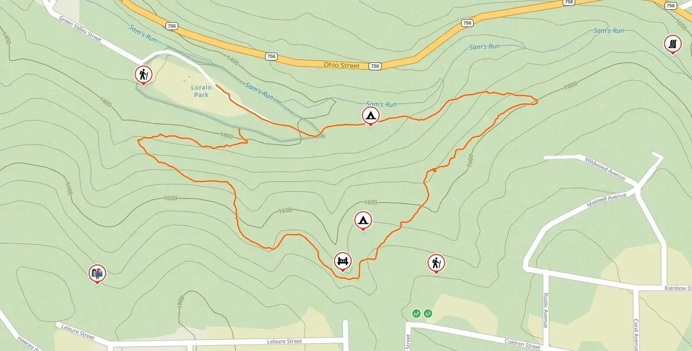
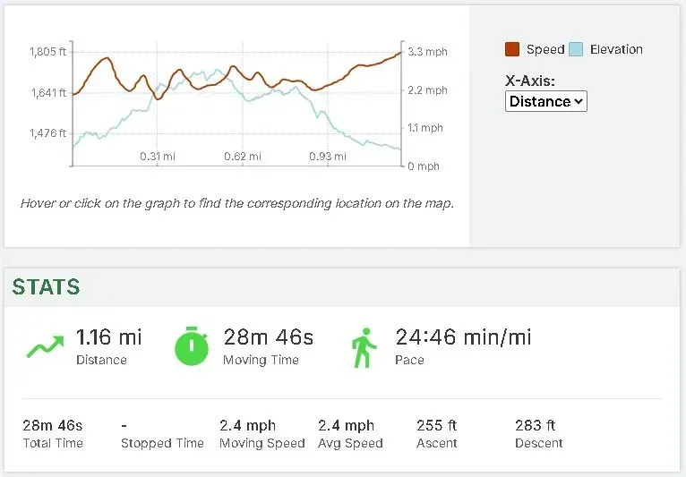
Historic Trail
The Historic Trail, was originally built in 1982. This trail had been left unmaintained for many years and we decided to recreate the trail and blazed it with orange circles with a historic name plate nailed into the trees.
Overlook Trail
The Overlook trail was recently added. This is a .5 mile spur off the Map of the Earth trail that is blazed in a baby blue color. This trail will give you a great unobstructed view of the City of Johnstown from our perspective!