GUIDED HIKES
2026 FREE GUIDED HIKE SERIES
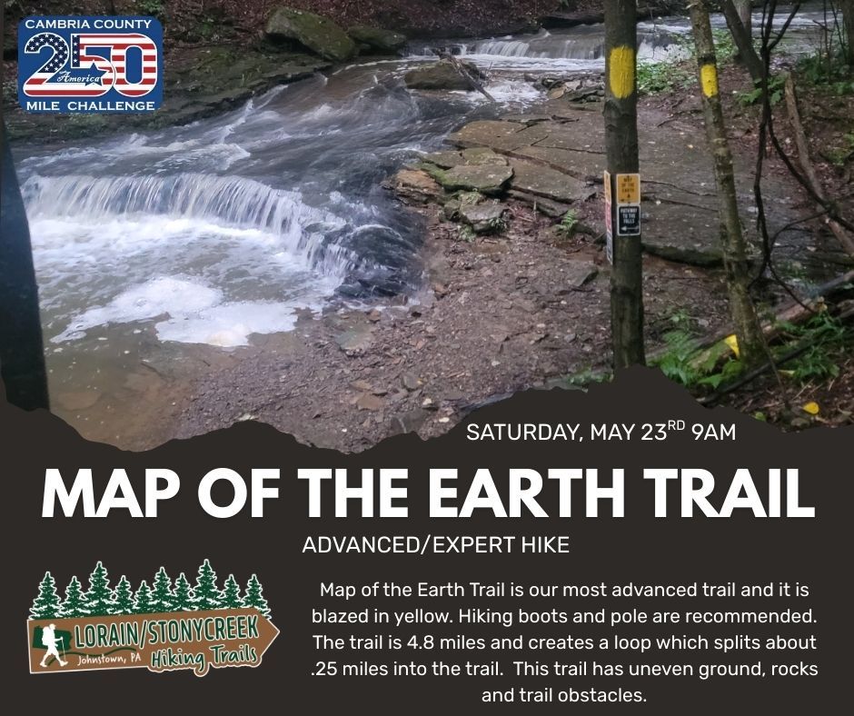
5/23/2026 - 9AM - LSHT Map of the Earth Guided Hike (4.85 miles)
6/14/2026 - 10AM - Wolf Rocks - Forbes State Forest - Guided Hike (4.2 miles)
7/29/2026 - 730PM - Buck Moon @ The OVERLOOK - Laurel Highlands HT (6.2 miles)
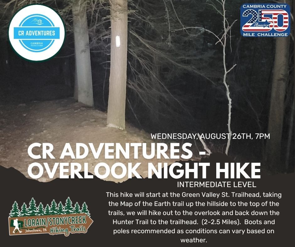
8/26/2026 - 7PM - CR Adventures - Overlook Night Hike at the Lorain/Stonycreek Hiking Trails (Approx. 2-2.5 miles)
9/12/2026 - 930AM - Standing Stone Trail - 1000 Steps
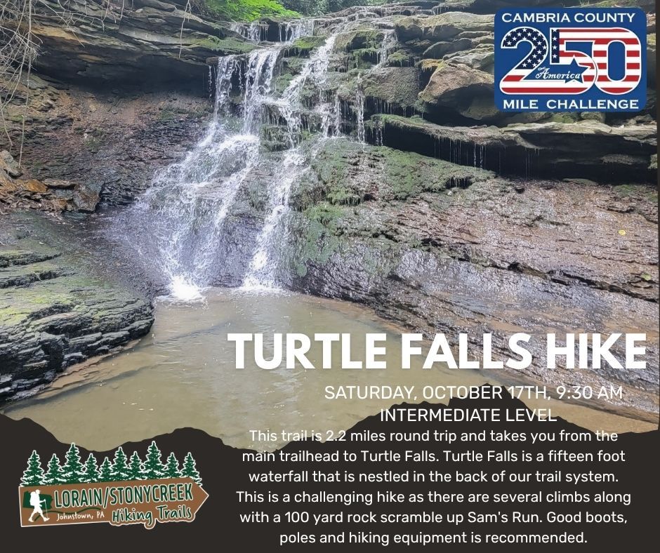
10/17/2026 - 930AM -Turtle Falls Hike at the Lorain/Stonycreek Hiking Trails (2.2 miles)


Guided Hikes - Western PA Adventures
HIKE PROFILES
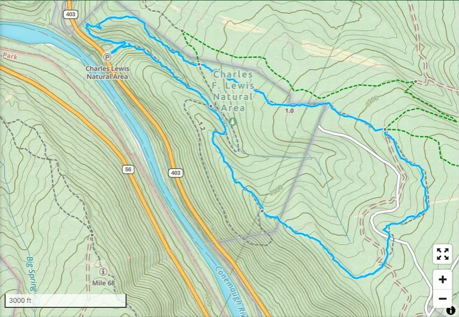
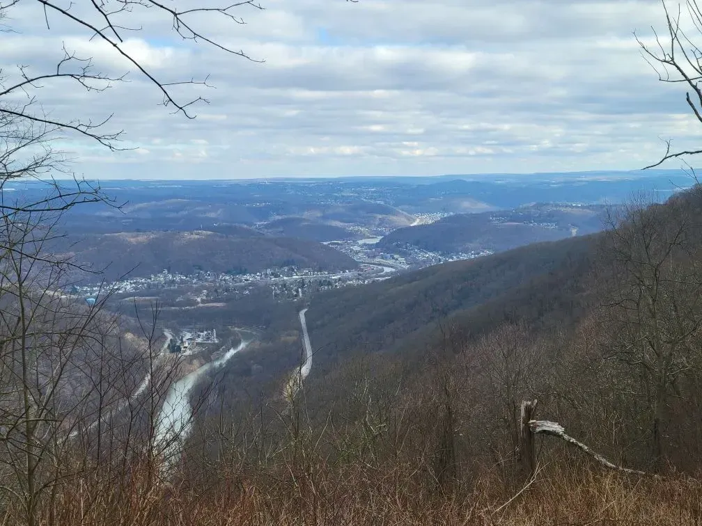
Charles F Lewis Natural Area (Rager Loop)
HIKE PROFILE -
Location: Charles F Lewis Natural Area, Gallitzin State Forest
Trail Rating - INTERMEDIATE
This is a 5 mile Loop with a 2.5 mile uphill climb at the beginning. There is a lot of natural water features that you see on the way up. When you get near the top you will come to the powerline where you can look over and see the LHHT.
On the way back down there is a fun little rock scramble followed by a nice vista!
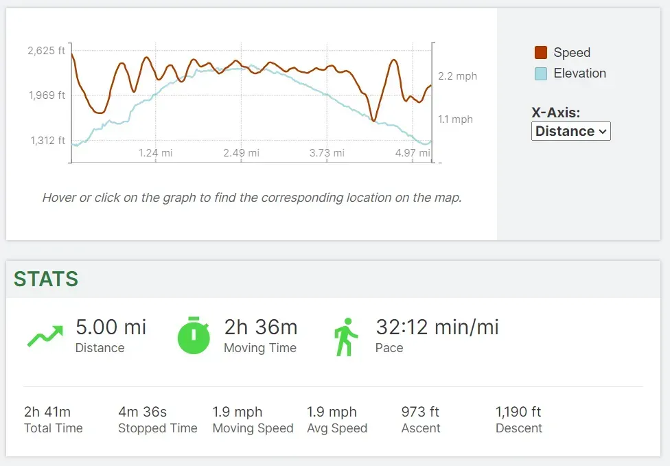
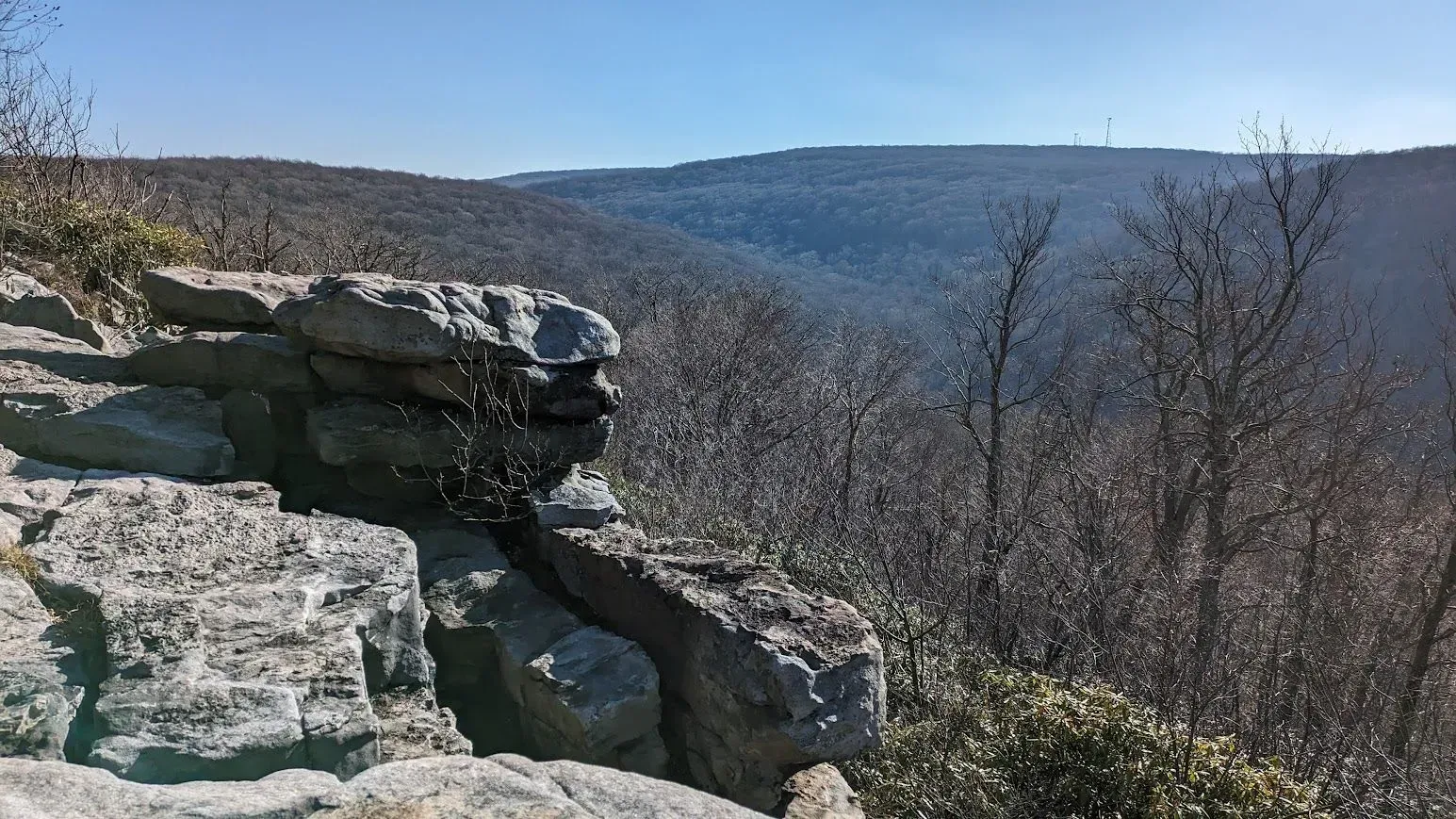
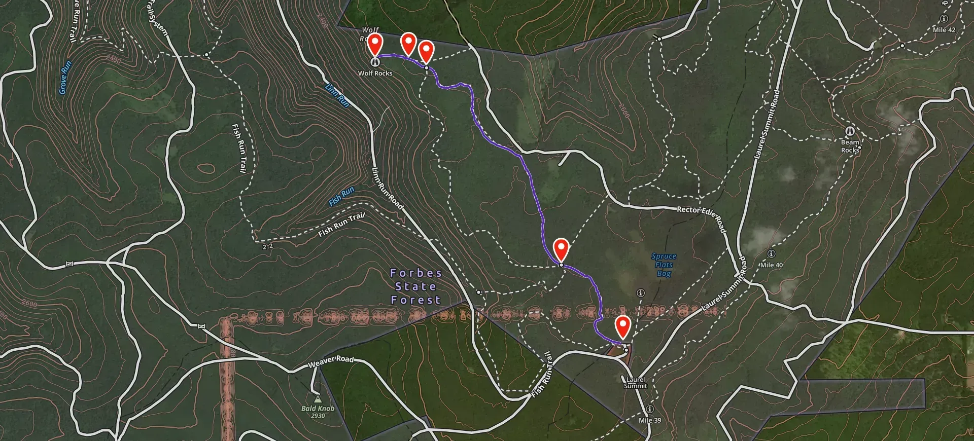
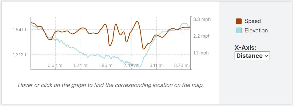
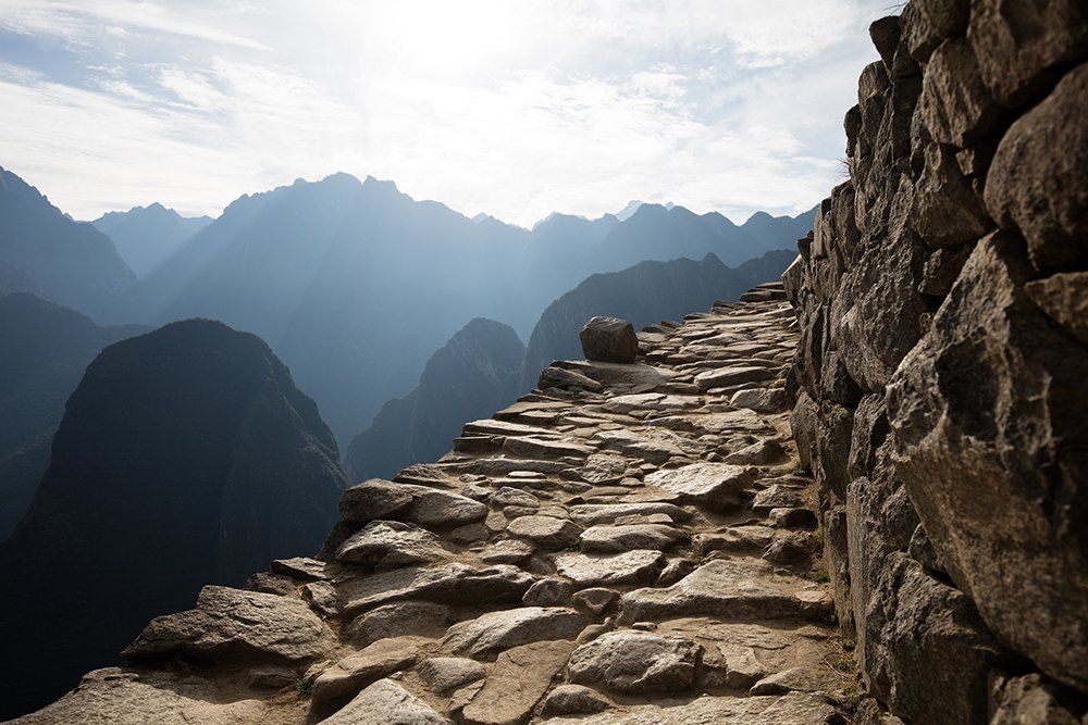
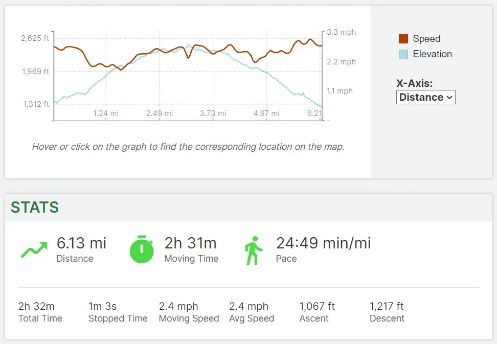
Wolf Rocks - Forbes State Forest
HIKE PROFILE -
Location: Forbes State Forest/Laurel Summit State Park Trails
Trail Rating - EASY
The profile below shows the terrain profile from the trailhead to Wolf Rocks. This is an out and back hike at 4.12 miles, but there are other options that can be chosen off the mail trail such as following the Wolf Rocks Loop back.
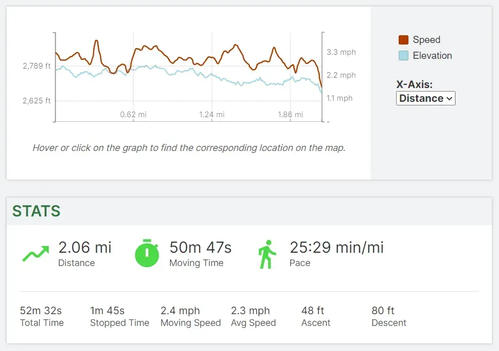
Waterfall Loop - Ohiopyle State Park
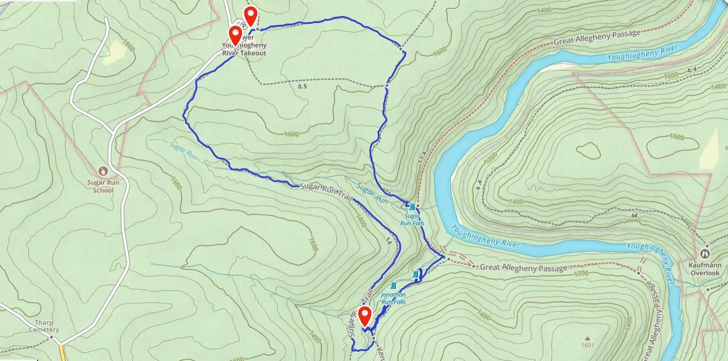
HIKE PROFILE -
Location: Ohiopyle State Park
Trail Rating - INTERMEDIATE
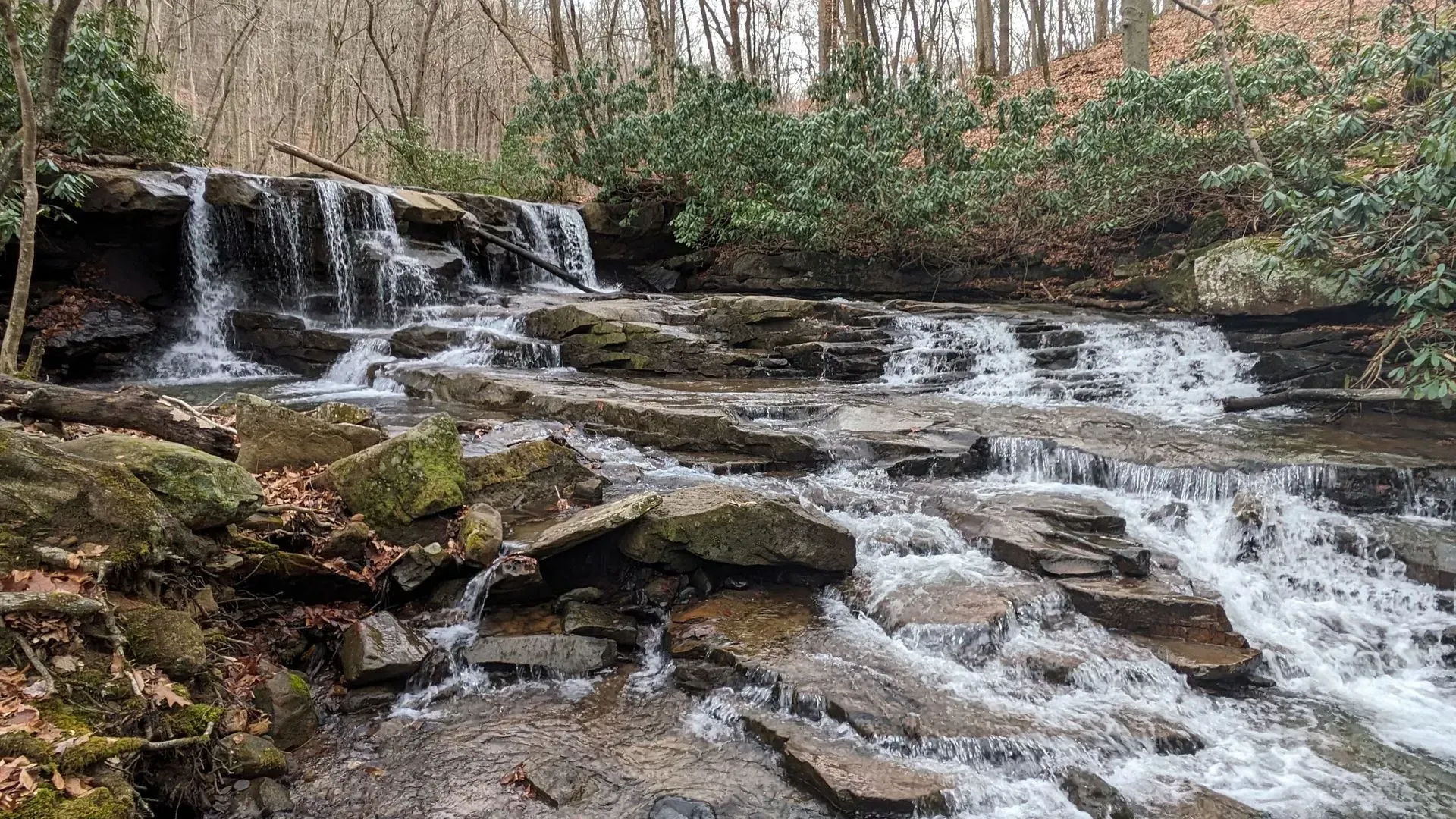
This loop starts at the Lower Youghiogheny River Takeout. You will take the Sugar Run Trail down the hill to Jonathan Run trail which crosses over a bridge over Jonathan Run to connect to the Kentuck Trail. The first set of falls is not far past the bridge, you have to take an unmarked trail down to these falls. This is the upper Jonathan Run falls
The second set of falls (Lower Jonathan Run Falls) is not much further than the first falls maybe a tenth to a quarter of a mile further. This is also on an unmarked trail to get down. The decent to the second falls is very tricky and on a steep incline with not too much footing. There is a rope to get down to the bottom navigating down big drops and rocks.
The hike will continue down the Kentuck Trail to the Great Allegheny Passage (GAP) where you will follow that to Mitchell Trail. The Mitchell Trail is a steep climb back to the top along Sugar Run. On this ascent, you will reach Sugar Run Falls about a tenth of a mile up the hill. There is a small cutoff on the Mitchell Trail to get to the bottom of Sugar Run Falls.
The hike back up to the top is a steep climb to about 1550ft where it starts to become more gradual as you reach the top to head back to the parking area.
PHOTO TOUR
There are great photo ops on every one of my guided tours, but this tour is especially designed for photographers who love taking photos as much as they love experiencing nature. We’ll go to a variety of locations which offer excellent photo opportunities of local flora, fauna and wildlife. Bring your own food, water, and photo equipment.
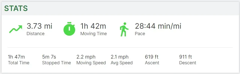
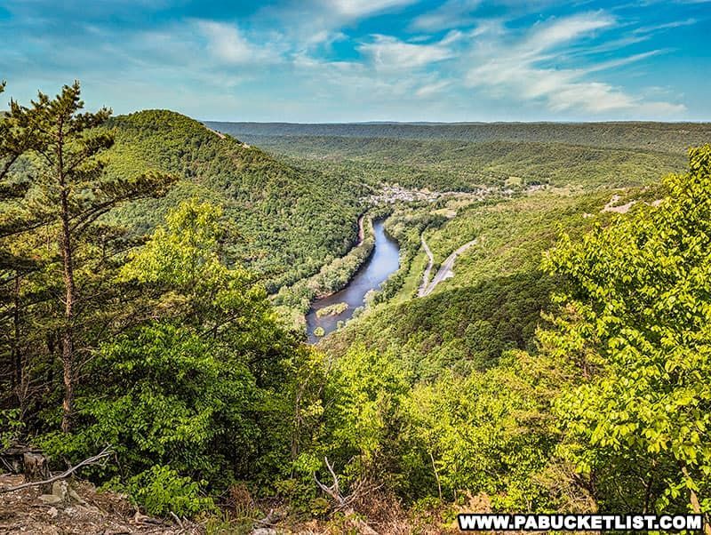
LHHT Mile 70 to Johnstown Overlook
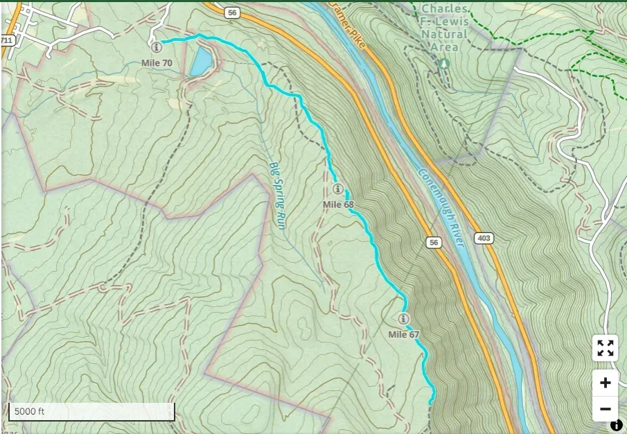
HIKE PROFILE -
Location: Laurel Highlands Hiking Trail - Seward, PA
Trail Rating - INTERMEDIATE
This will be an intermediate level hike due to the nature of the uphill climb and the number of miles we will be hiking. We will be hiking to the overlook on the Laurel Highlands Hiking Trail. Anticipate a 6.2 mile hike. Bring headlamps, poles and good boots or hiking shoes!
Standing Stone Trail - 1000 Steps
HIKE PROFILE -
Location:
Trail Rating - INTERMEDIATE
This